Refreshing Riverina Highlands

Find out why the waterways of the Riverina Highlands are so important, and how we can work together to improve waterway health

Why Riverina Highlands?

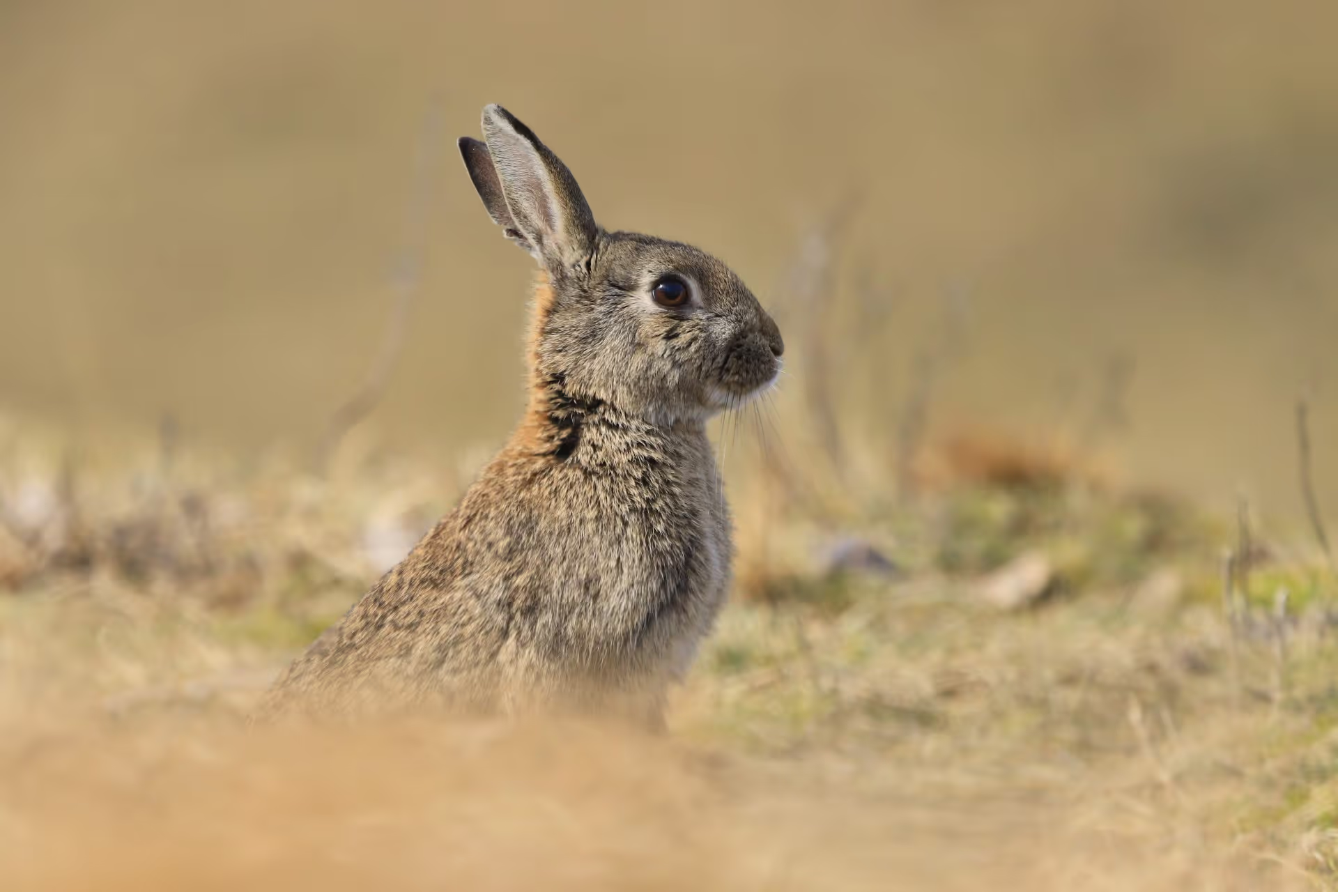
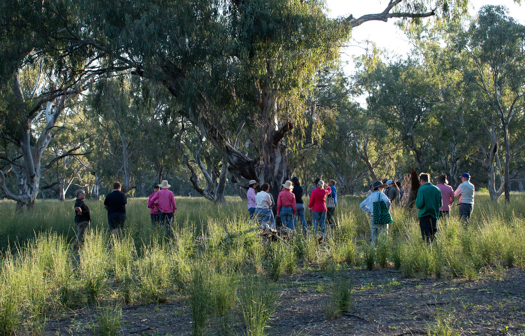
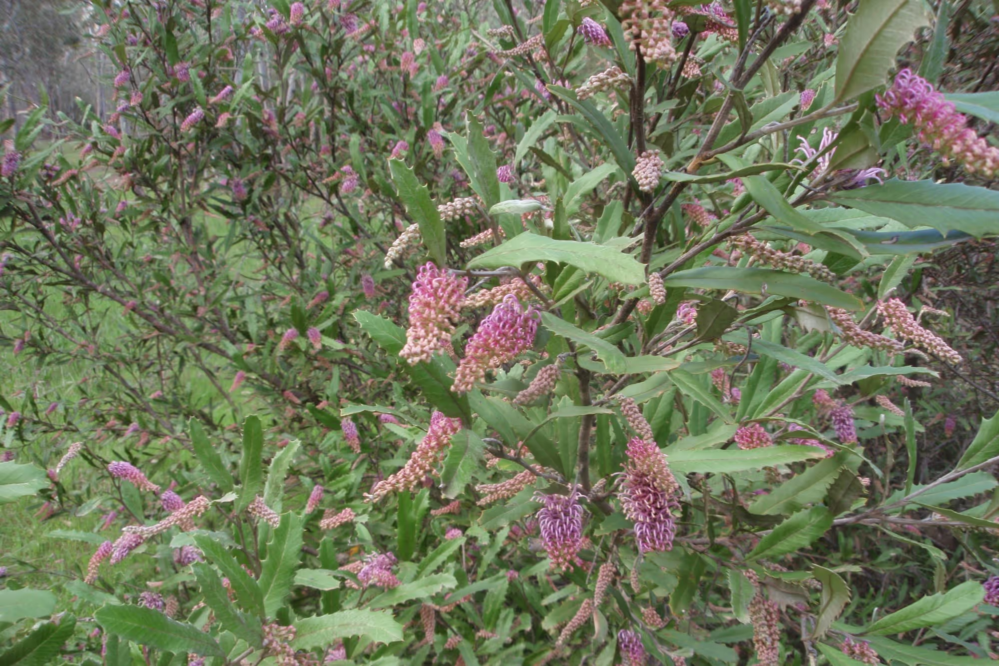
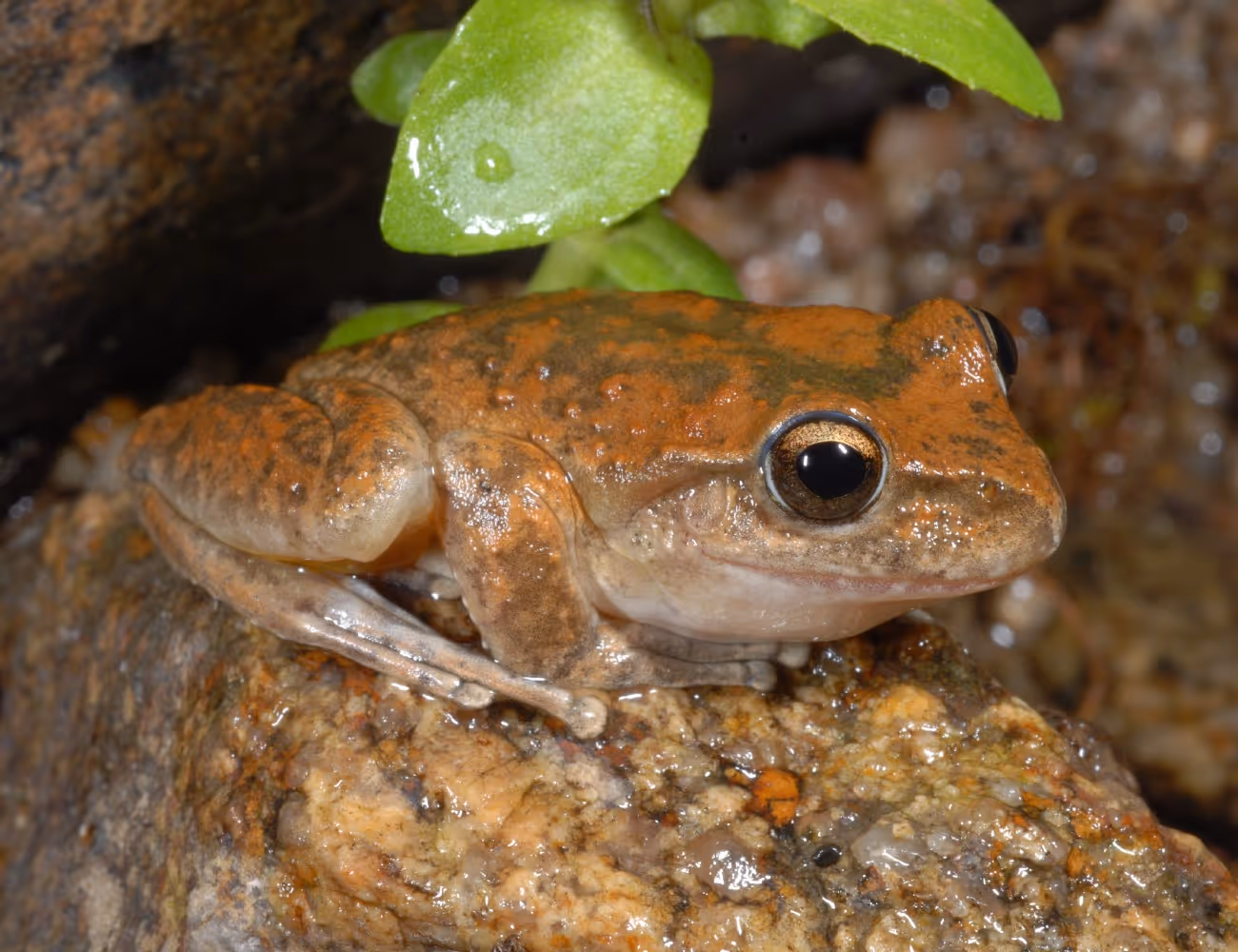
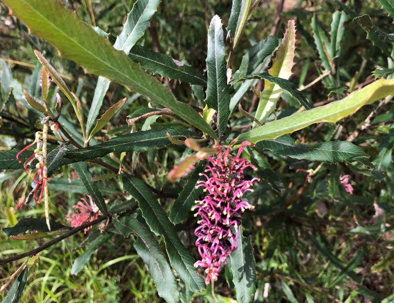
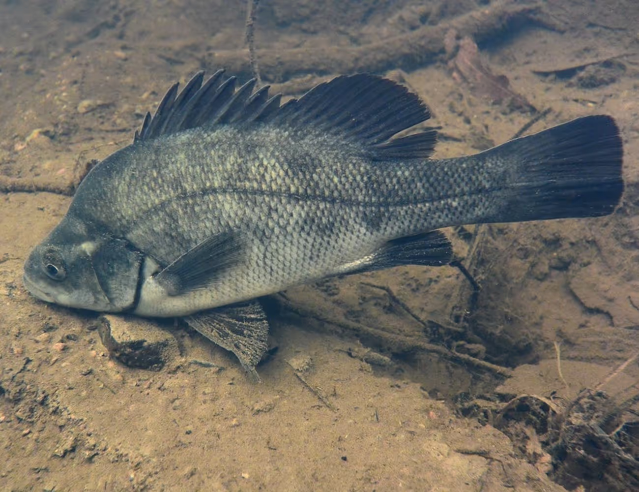
The Riverina Highlands is home to unique waterways, historic sites, and a range of special native species, and supports over 1100 landholders with a focus on grazing agriculture. The area broadly aligns with the traditional country of Wiradjuri First Nations people, and has been a meeting place for many different Indigenous nations over thousands of years.

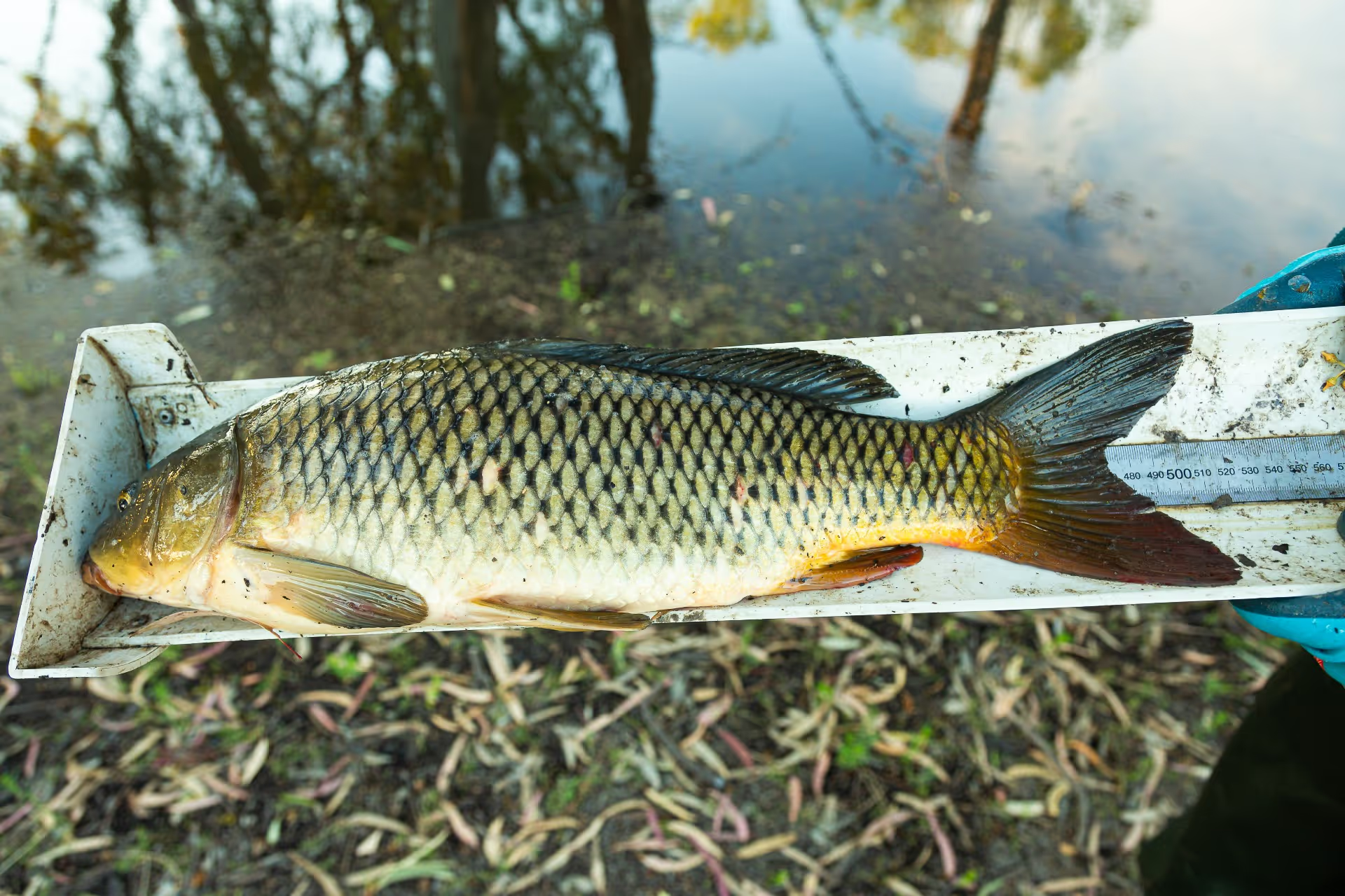
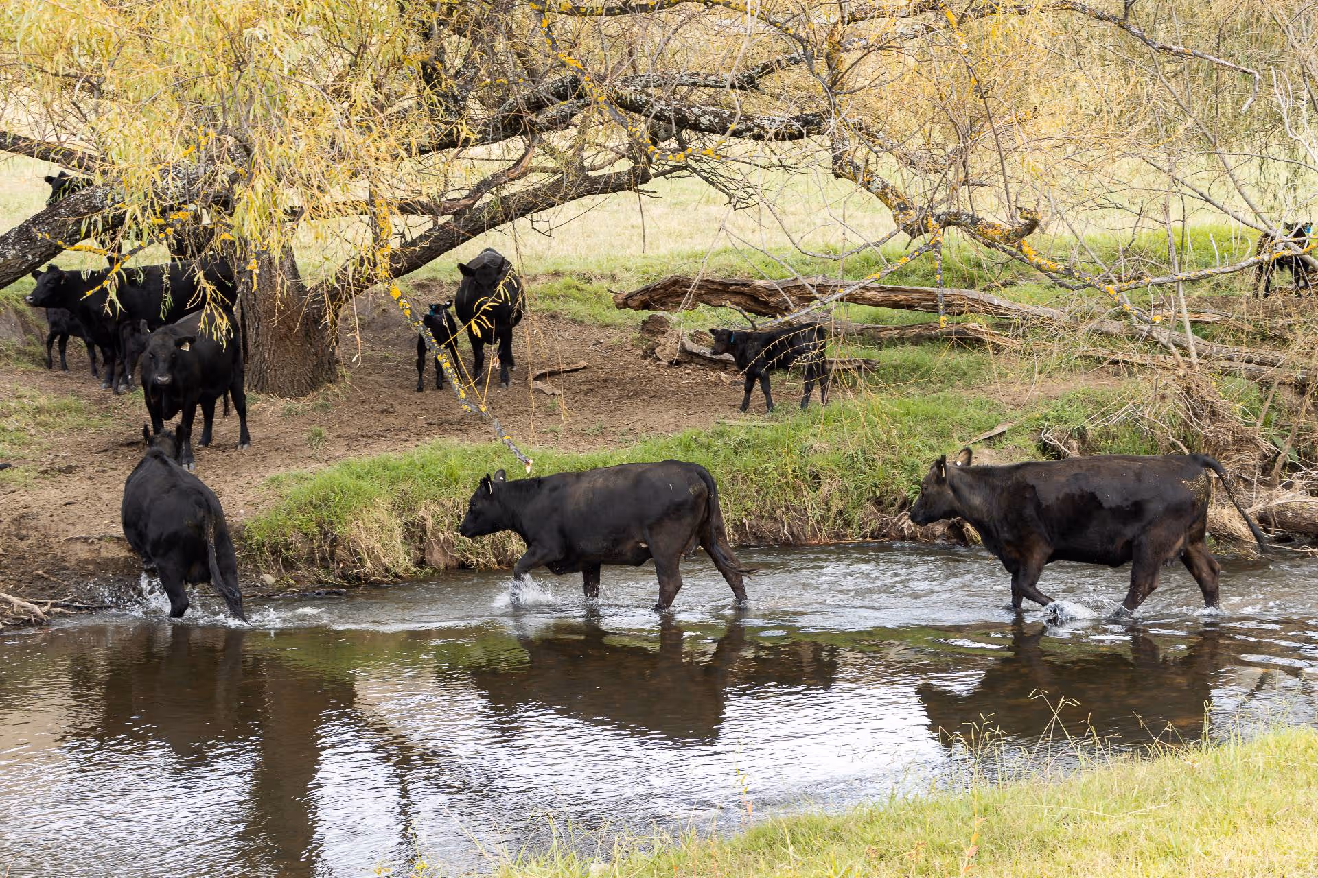
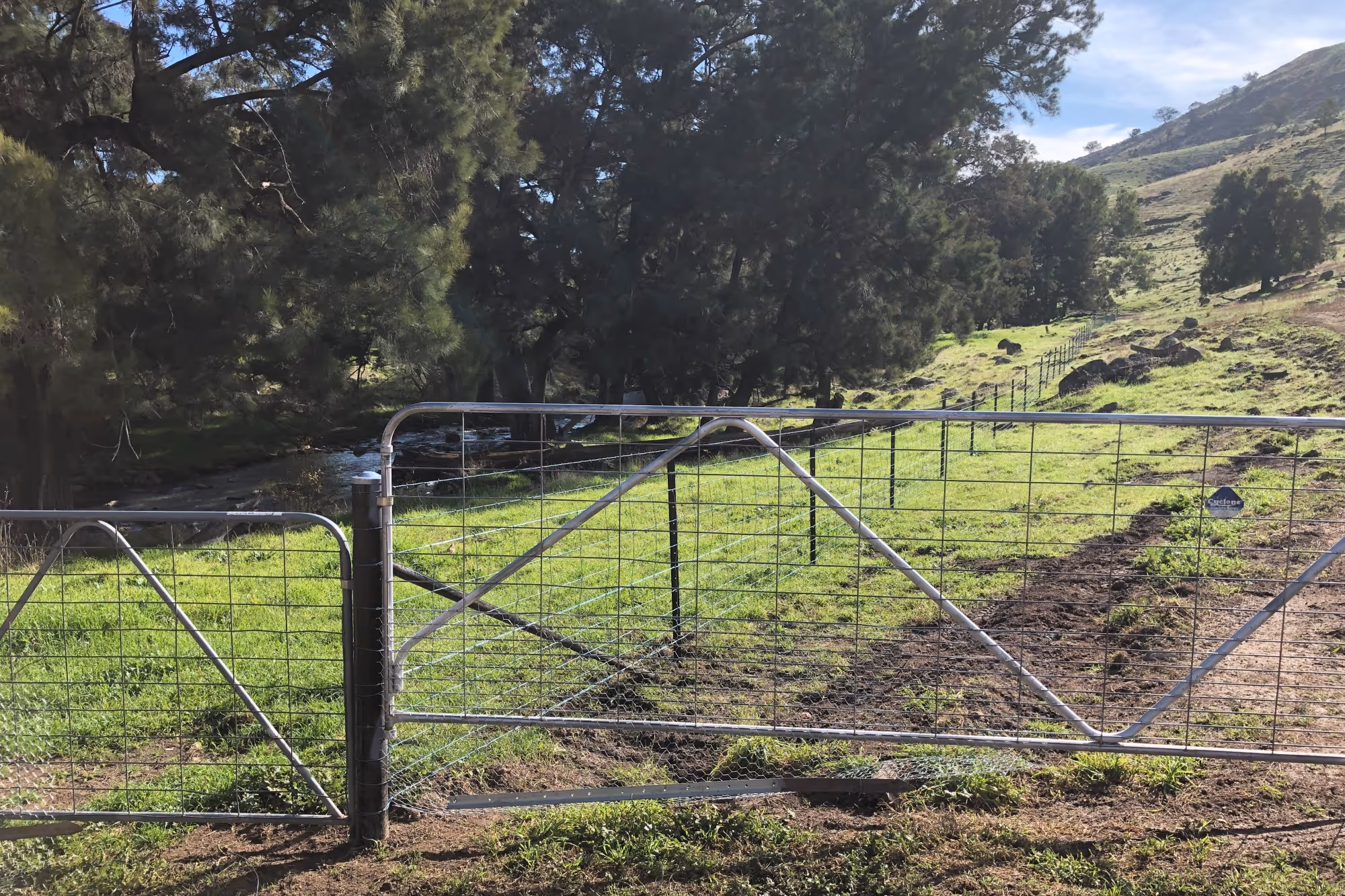
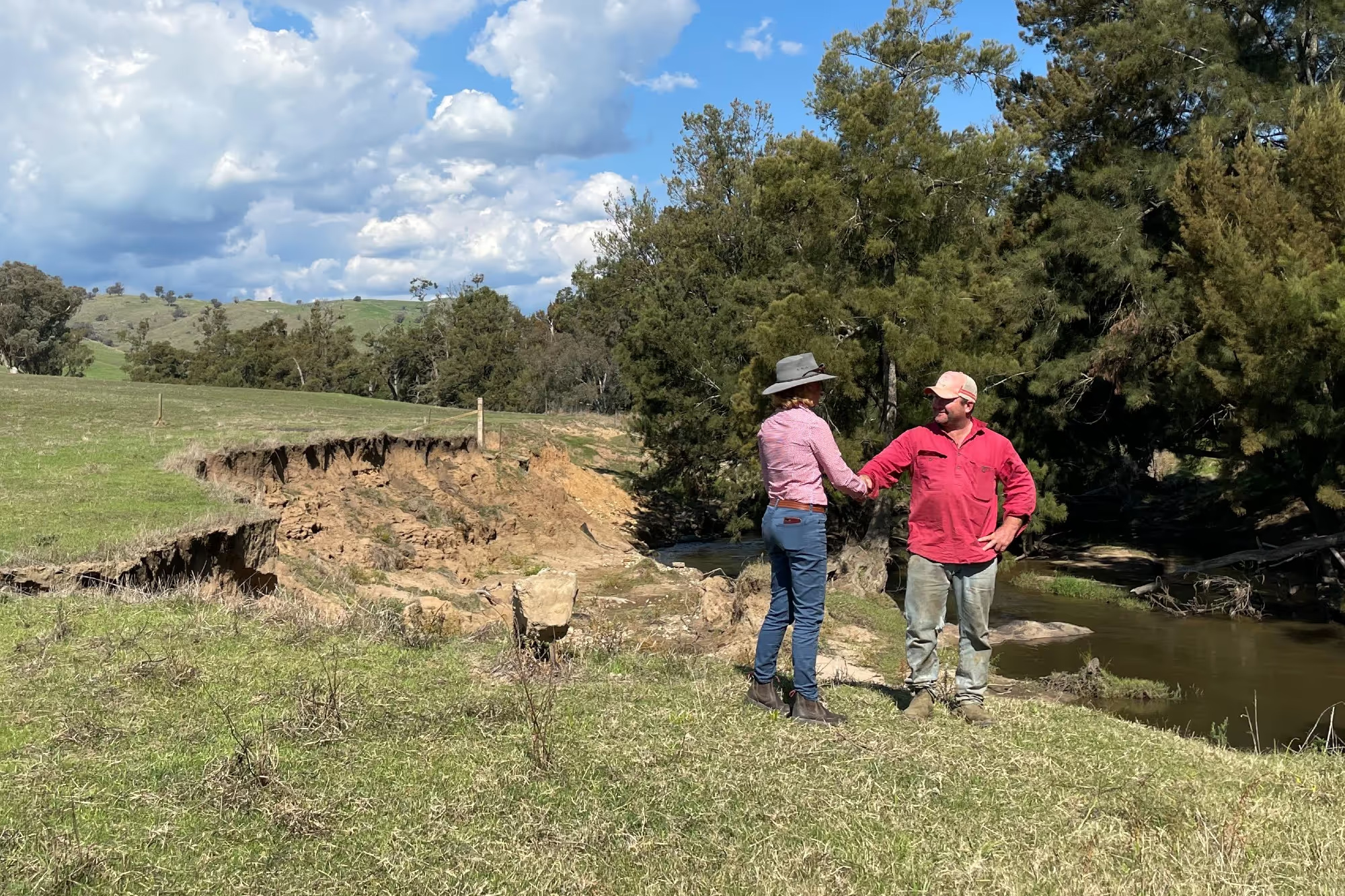
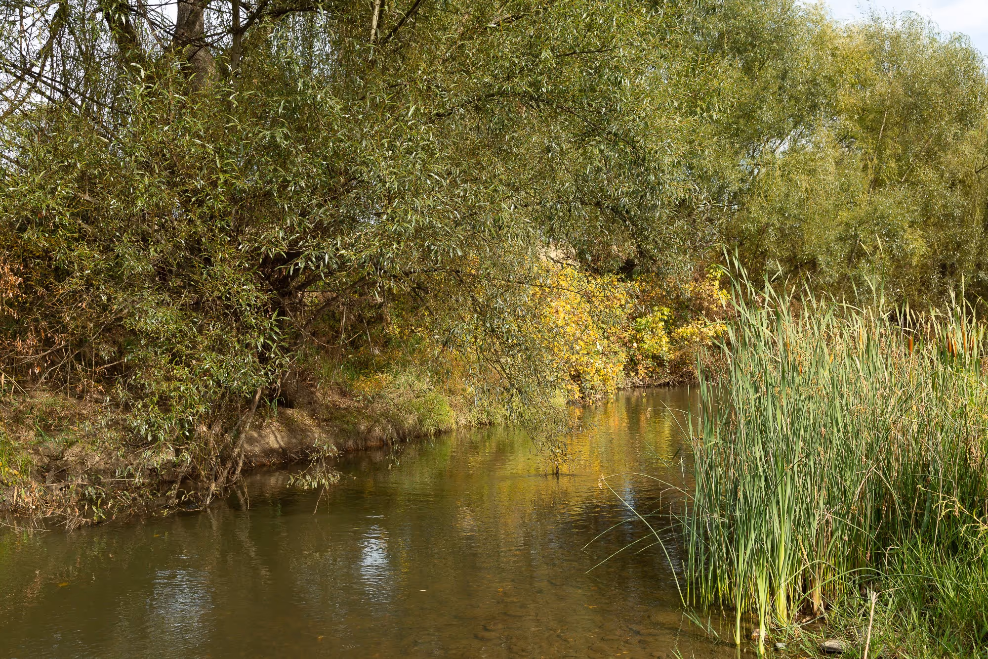
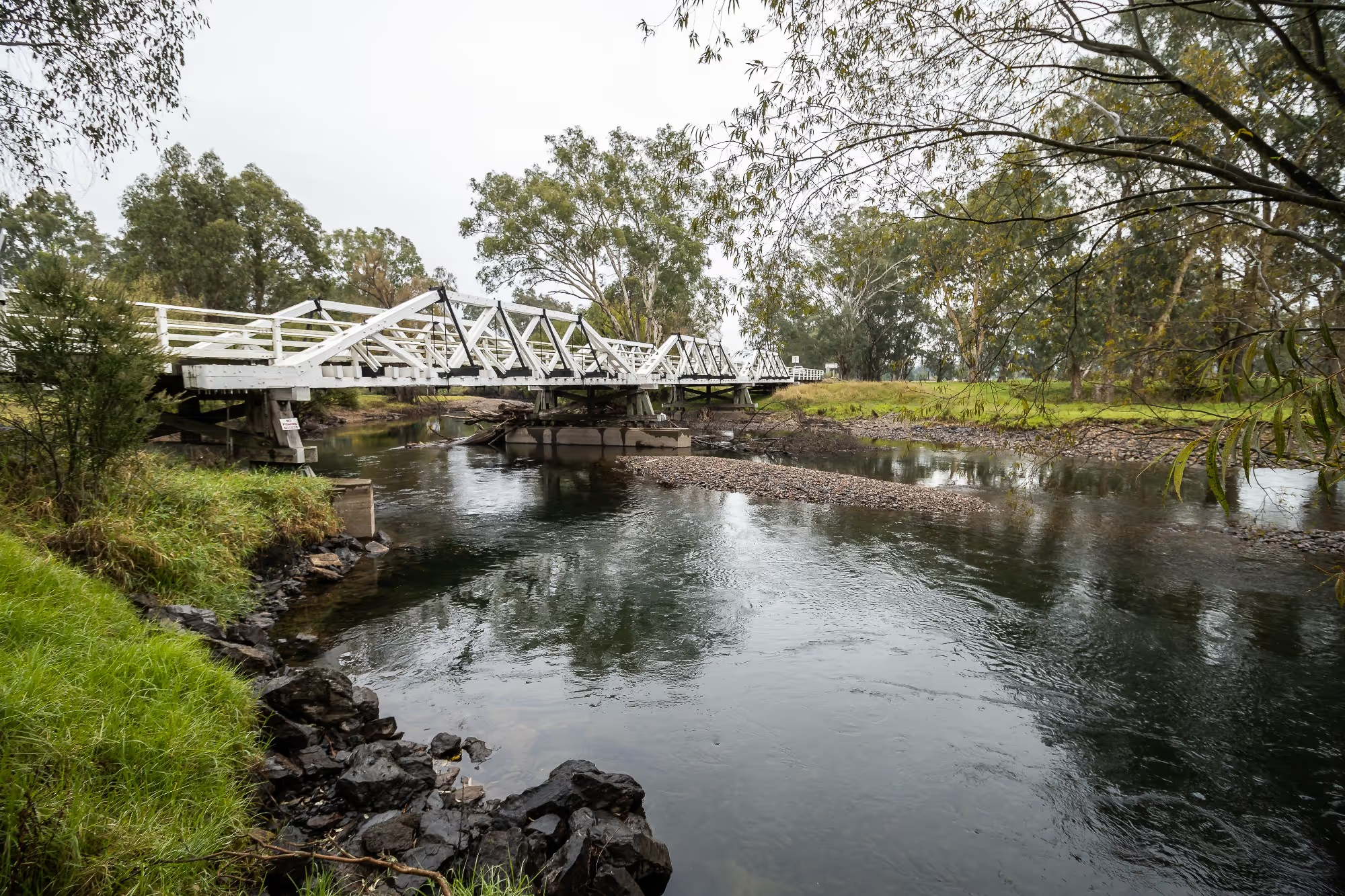
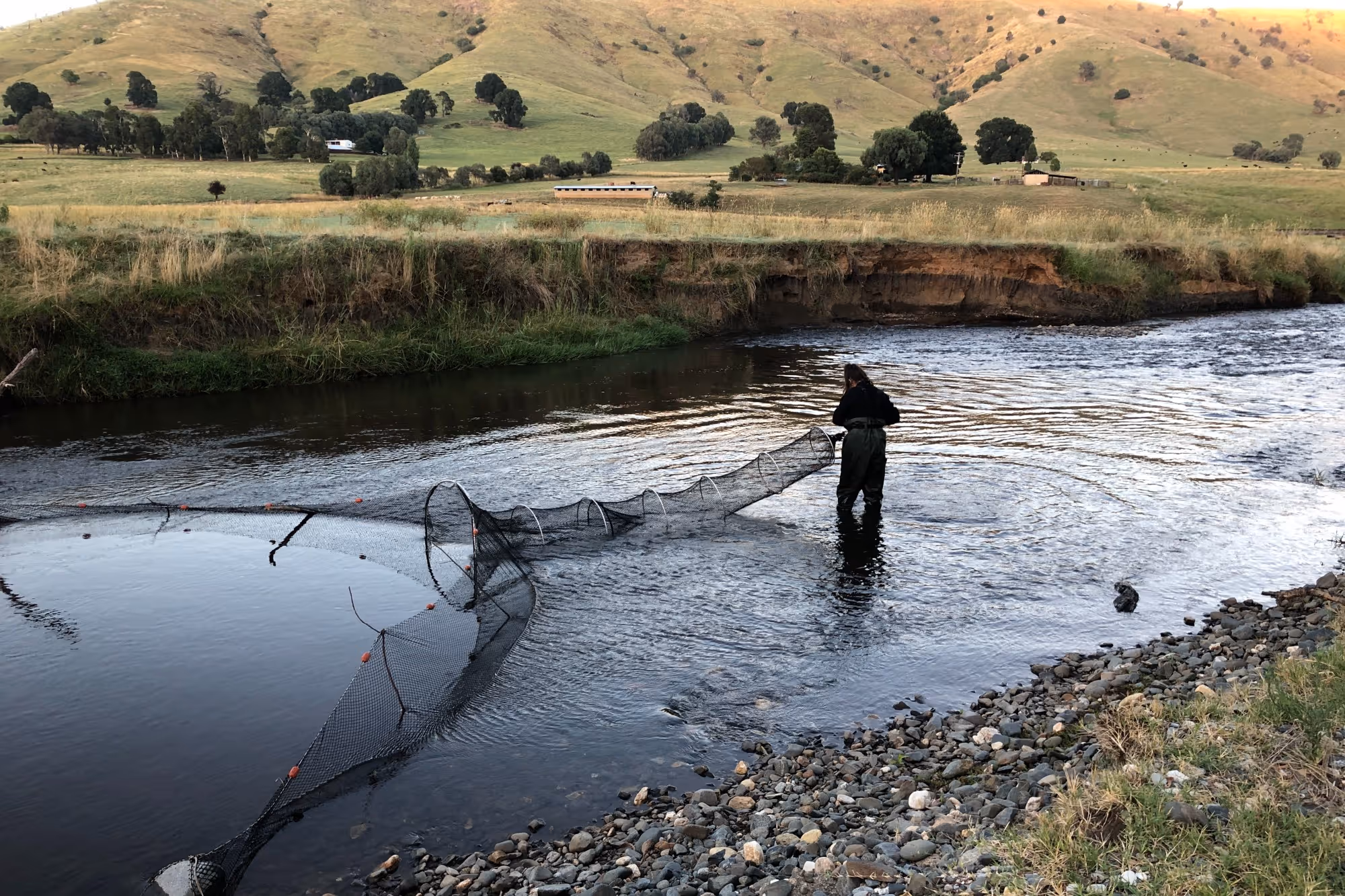
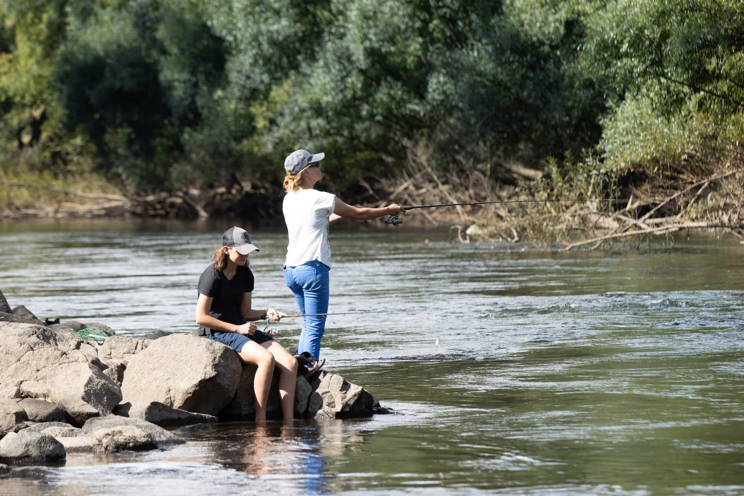
Waterways are the heart and soul of the Riverina Highlands community and landholders are inherently linked to their management. Supporting good water quality for domestic needs, livestock and recreation, and providing habitat for local animals is a focus for this community. 

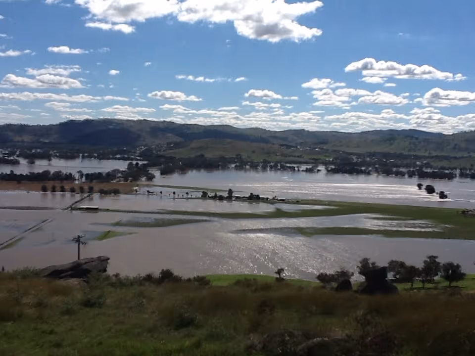
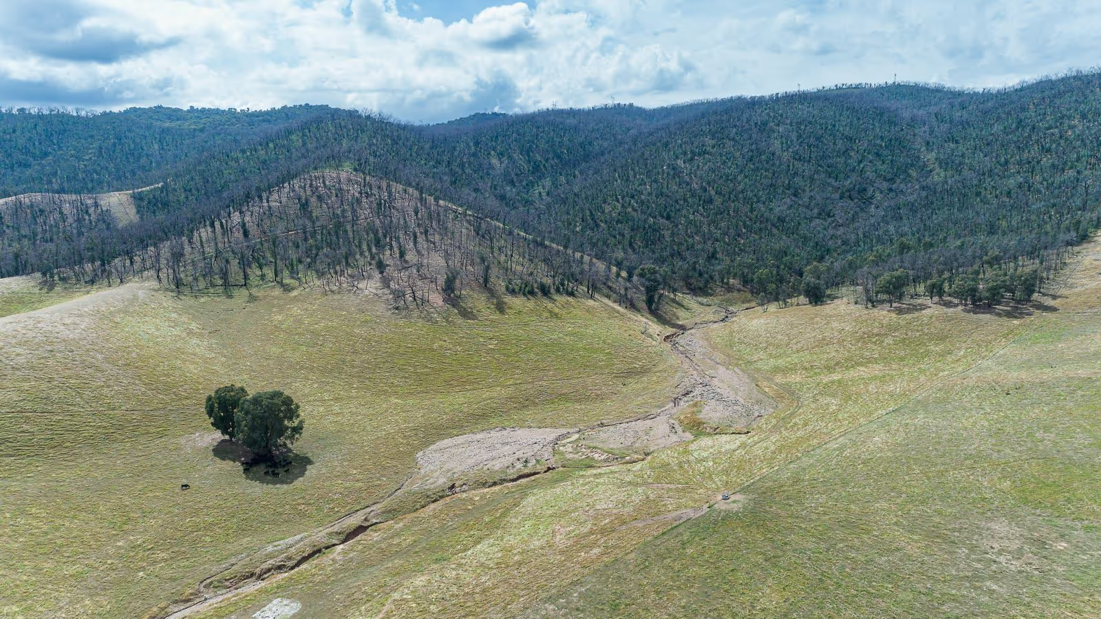
With recent fires, floods and droughts, waterway health in the Riverina Highlands is declining, and increased bank erosion is leading to loss of productive land. The solutions require a community effort, and together we can act to improve the condition of our waterways.

JUMP TO RECOMMENDED ACTIONS

Talk to our Riverina Highlands Project Officer

Cherie White

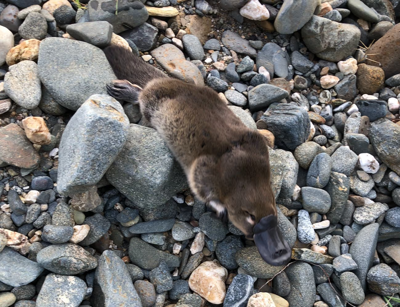
Favourite plant or animal: Platypus (Ornithorhynchus anatinus)

0427 407 126

cherie@refreshingrivers.org.au

Riverina Local Land Services, working closely with Riverina Highlands Landcare Network, Riverina Highlands Landcare Nursery and Brungle Tumut Local Aboriginal Lands Council

"There are not too many jobs where you can physically see the difference you have made. I enjoy working with landholders to design their projects and I love going back and revisiting sites to see how these projects are making a difference to the way landholders manage their land."

A shared vision for the Riverina Highlands

When we asked the local community what they envision our waterways to be in 30 years’ time, these were their responses:

"Improved water quality free of sediment and other contaminates. Stabilised creek banks with good weed control and a healthy aquatic environment with native species."

"A well vegetated and protected waterway where stock grazing is excluded from direct access to the waterway's edge."

"Improved water quality with less sediment and nutrient loads entering the main drainage lines."

"Active measures taken to slow the movement of water through the system, where possible, to help reduce impacts of the high erosion events that occur in periods of high rainfall with the adjacent flood plains having inadequate ground cover to slow the inflows down."

"A river that has good riparian vegetation. It doesn’t have a lot of weed species. It has lots of habitat features."

"That it continues to be a reliable high quality source of water and supports both environmental assets and production systems."

Sub-catchment Values in the Riverina Highlands

The Riverina Highlands catchment is made up of seven sub-catchments. A Waterway Management Plan for the Riverina Highlands has been co-created by the community, landholders and project partners, and each sub-catchment has an associated iconic species that will help demonstrate and communicate progress against the Plan in coming years.

Click on each sub-catchment in the map below to find out more.

Natural wetlands

Natural wetlands, such as billabongs, soaks, swamps and seasonally wet areas, are a top priority for the community, according to survey results.

Wetlands are an important habitat for native plants and animals, and are breeding grounds and nurseries for invertebrates, fish, frogs and waterbirds.

Wetlands are also valued for the ecosystem services (benefits to humankind provided by natural ecosystems) that they provide. These include direct economic benefits like food and fresh water, as well as their capacity to filter pollutants and sediments in water, and to retain or slow floodwaters.

Important wetlands in the Riverina Highlands include:

  • Tomneys Plain, a nationally listed wetland and home to an endangered ecological community
  • Tumut Wetlands, a series of lagoons fringed by native reeds and River Red Gum forests, providing habitat for more than 70 different bird species
  • Floodplain wetlands on private land, which provide important ecosystem services and are an important natural asset on farms.

Right: Tumut wetlands. Credit: Local Land Services

Rare plants, wildlife and habitats

The Riverina Highlands community values rare and iconic plants, animals and habitats, and the Refreshing Rivers Program provides an opportunity to do more to protect these.

The Waterway Management Plan particularly focuses on the following rare and threatened species and ecological communities:

  • Tumut Grevillea (nationally endangered), occurring in a 6km stretch of the Goobarragandra River and in a small population near Gundagai
  • Booroolong Frog (endangered) and its habitat
  • Macquarie Perch, which is only found in four streams within the Murray-Darling Basin
  • Platypus, an iconic species found on all major streams in the Riverina Highlands, but vulnerable to changes to water flow, land clearing and predation
  • Lowland Murray River Aquatic Endangered Ecological Community
  • White Box-Yellow Box-Blakely’s Red Gum grassy woodland and Derived Native Grassland.

Booroolong Frog. Photo credit: David Hunter

Tumut Grevillea

Platypus

Macquarie Perch. Photo credit: NSW DPI

Remnant native vegetation and connectivity

The Riverina Highlands community values rare and iconic plants, animals and habitats, and the Refreshing Riverina Highlands Program provides an opportunity to do more to protect these.

The Waterway Management Plan particularly focuses on the following rare and threatened species and ecological communities:

  • Tumut Grevillea (nationally endangered), occurring in a 6km stretch of the Goobarragandra River and in a small population near Gundagai
  • Booroolong Frog (endangered) and its habitat
  • Macquarie Perch, which is only found in four streams within the Murray-Darling Basin
  • Platypus, an iconic species found on all major streams in the Riverina Highlands, but vulnerable to changes to water flow, land clearing and predation
  • Lowland Murray River Aquatic Endangered Ecological Community
  • White Box-Yellow Box-Blakely’s Red Gum grassy woodland and Derived Native Grassland.

Riparian Sheoaks

Clean water for drinking, domestic use and livestock

Clear, clean water, free of sediment and other contaminants, is important to a community which relies heavily on river water for domestic, stock and town use. Management of riparian zones (the land alongside waterways) is extremely important for maintaining water quality. As a shared asset which passes through land managed by a variety of landholders and agencies, waterway, riparian and catchment management is a collaborative process.

Pump to enable off creek stock watering

Solar panel to power pump

Water tank

Cattle in Gilmore Creek

Revegetated areas

Approximately 54 km of waterways in the catchment have been revegetated over the past 14 years. The community who took part in surveys about the catchment saw revegetation as key to future management of the catchment.

While revegetation, both existing and future, is seen as important, there are new challenges to tackle, including reductions in government funding as well as climate change. The Refreshing Riverina Highlands Program provides an opportunity to shape revegetation works for the coming years to respond to these emerging challenges, and to support long-term survival of vegetation species and communities.

Tumut River Revegetation

Recreation

Waterways and riparian areas in the Riverina Highlands arehighly valued for recreation. Locals and visitors alike enjoy camping, fishing,swimming, kayaking and canoeing on the rivers and creeks and on Blowering Dam.

Parts of the catchment have significant tourism appeal,including Adelong Creek and the historic remnants of gold mining found at theAdelong falls Gold Mill Ruins. The Hume and Hovell walking track passes throughthe catchment, providing opportunities for both short hikes and longermulti-day trips. Kosciuszko National Park also overlaps the upper catchment.

Fishing in the Tumut River

Indigenous cultural values and Connection to Country

The Riverina Highlands broadly aligns with the Wiradjuri nation and has a rich cultural history. The area was a meeting place for different Indigenous Nations including Ngunawal people from the north east, Walgalu people from the south-east and Wiradjuri people from further west.

Traditional Custodians have managed their land here for over 40,000 years. Scar trees, ring trees, stone artefacts, Bora Rings and rock paintings reveal the depth and complexity of Wiradjuri connection to country and past land management practices.

Partnerships with Traditional Custodians including the Brungle-Tumut Local Aboriginal Land Council are being fostered to support two-way exchange of ecological knowledge, and to support the Aboriginal community to continue to care for country as they have done for thousands of years.

Some of the activities that have occurred in partnership include:

  • Cultural burning on public lands
  • Seed collecting training and mentoring
  • Contract weed spraying to help protect significant sites
  • Cultural heritage assessments.

A scar tree in the Riverina Highlands

Tumut Grevillea Seed collecting

Learn more about actions you can take to support these values.

Main threats to our waterways in this Target Area

Below are some of the factors threatening waterway health, ranked by the community:

Weeds

Stream bed and bank erosion

Aquatic pests

Pest animals

Changes to natural flows

Unrestricted stock access and grazing of riverbanks

Climate change and natural disasters

Clearing of native vegetation

Forestry in the upper catchments

Weeds

Weeds were identified by the community as the greatest threat to waterways in the Riverina Highlands. Some of the problems caused by weeds include:

  • out-competing native species, ultimately causing declines in native vegetation and loss of diversity
  • forming dense thickets which smother native vegetation
  • weeds such as willow choke channels and can cause floodplain inundation, waterway diversion or erosion
  • loss of productive capacity.

Willows and Blackberry are particularly problematic weeds, and several species of willow are Weeds of National Significance. Other common weeds include:

  • Poplar, Plane trees, Hawthorn, wild Plum, Privet
  • a range of herbaceous weeds including St Johns Wort, Paterson’s Curse, Thistles, Hemlock and Fennel
  • sprawling weeds (e.g. Blue Periwinkle, Tradescantia)
  • pasture weeds (Serrated Tussock and Chilean Needle grass).

One complication for weed management is that many exotic species are also valued by the local community, such as Poplars and Plane trees that produce colourful autumn displays in townships. These species require a different approach to ensure they don’t escape from towns along waterways.

Dense growth of Willows along Adelong Creek.

Stream bed and bank erosion

Stream bed or bank erosion was identified by the community as the second highest threat in the catchment. Abnormally wet seasons experienced in 2021 and 2022, with associated flooding, have exacerbated erosion throughout the Riverina Highlands.

Although erosion is a natural process, it can be much more serious and happen much faster in areas where vegetation has been removed, or changes to flows occur leading to deeper and wider channels.

Erosion can lead to turbidity and reduced water quality, loss of riparian land and of associated vegetation (including large trees), and destruction of fences, bridges and roads.

Erosion also leads to increased sedimentation, which can bury cobble bed streams that provide important habitat for threatened species, including the Booroolong Frog and Macquarie Perch.

Gilmore Valley bank erosion.

Aquatic pests

Aquatic pests are a significant concern in the catchment. The main aquatic pests are noxious fish such as Carp and Redfin, and introduced species such as Rainbow and Brown Trout. The biggest concern is the impact these species have on threatened native species such as Macquarie Perch.

It is possible to reduce pest species numbers in a small system like the Adjungbilly Creek, where removal efforts are already underway, but monitoring and control needs to be ongoing, as would occur for a terrestrial pest species.

Protecting, enhancing and re-establishing riparian vegetation is also an important part of reducing the impact of aquatic pests.

Carp are one of the worst introduced pest species in Australia.

Pest animals

Pest animals in the Riverina Highlands which impact on waterway health include feral horses, goats, deer, pigs and rabbits. Pests can damage native riparian vegetation through grazing, worsen bank erosion, facilitate weed invasion and reduce water quality through manure inputs and increased turbidity.

Rabbits are one of Australia's most destructive pest animals.

Changes to natural flows

The Tumut and Murrumbidgee Rivers and their floodplains have highly regulated flows, which can threaten some physical and biological processes that relied on unregulated systems. These threats include:

  • Storing winter and spring rainfall then releasing it for irrigation in summer reverses natural flow regimes, interrupting native fish spawning triggers.
  • ‘Cold water pollution’ occurs when water released from dams (i.e. Burrinjuck and Bowering Dams) is colder than natural flows. This cold water isn’t suitable for native large bodied fish, instead favouring exotic species including Trout.
  • Sudden changes in water releases cause riverbank slumping, leading to increased erosion and loss of riparian vegetation, especially large River Red Gums.
  • Riverbanks are saturated for longer, impacting the natural wet-and-dry cycles of some wetlands.

Addressing these threats is challenging, as it requires balancing the needs of irrigators and economic values (including using waterways as conveyance channels to move water quickly downstream) with environmental values.

Murrumbidgee River in flood.

Unrestricted stock access and grazing of riverbanks

Unrestricted stock access and grazing of riverbanks damage waterways and riparian areas in a number of ways, including:

  • localised bank erosion from livestock trampling
  • destruction of groundcover, reducing bank stability and increasing vulnerability to further bank erosion
  • reduced water quality due to increased turbidity and increased nutrient loads from manure
  • loss of riparian native vegetation (especially aquatic reeds).

Over the past 14 years, over 32 hectares of riparian land in the Riverina Highlands has been fenced from stock access to address bank erosion. Many people in the community understand the threat of stock access to waterways and believe that there is more work to be done.

Cattle in creek.

Climate change and natural disasters

Survey respondents identified climate change and associated natural disasters such as bushfire, flood and drought as important threats.

In the last decade alone, the Riverina Highlands catchment has experienced significant drought, multiple flood and severe bushfires. All of these have damaged waterways, through increased streambank erosion, loss of riparian vegetation, loss of habitat for aquatic species, increased water temperatures and reduced water quality.

Healthier waterways are more resilient to natural disasters. The Refreshing Rivers Program provides an opportunity to build resilience into the catchment, including by revegetating wide buffers along waterways and restricting stock access. Increased vegetation slows floodwaters, reducing erosion; while larger riparian buffers and increased ground cover also help protect waterways from high levels of sediment and nutrients that flow into streams after fire.

Gilmore Valley after the 2019-20 bushfires.

Clearing of native vegetation

Clearing of native vegetation was also listed as a threat by the survey respondents. Historically vegetation would have been cleared in the catchment for agriculture, forestry and horticulture, and the establishment of townships. Today, the loss of paddock trees and riparian vegetation in some areas continues.

Retaining large old trees and remnant patches of vegetation, and protecting or enhancing riparian vegetation, is extremely important for landscape resilience, increasing biodiversity, and for protecting many of the values the community cares about.

Vegetation clearing.

Forestry in the upper catchments

Forestry operations exist mostly in the upper catchments and are generally plantation forestry, occurring where native vegetation has been cleared and pine plantations established in the past.

Key impacts of forestry include the fragmentation of native vegetation, harbouring of pest animals and plants and sedimentation of waterways during or after harvesting. Forestry roads are also likely to be a major source of sediment input to waterways. Sedimentation, particularly in the Adjungbilly Creek, threatens cobble bed habitat for the Booroolong Frog and Macquarie Perch.

Forestry in the Riverina Highlands.

Improving waterway health for current and future generations

The Refreshing Riverina Highlands Waterway Management Plan is co-created by the community, landholders and project partners. It builds on past successes and existing management strategies in Riverina Highlands, and provides the foundations for our work.

You can download the full Waterway Management Plan below, or scroll down to see our recommended priority actions for landholders.

If you are interested in getting guidance for your property or tackling a specific problem, get in touch with Cherie.

Download the waterway management plan

Actions landholders can take to refresh the Riverina Highlands

Discover the natural value of your land!

Book your free Natural Capital Profile with the Refreshing Rivers team

Recognising and valuing your farm’s natural assets is a great first step towards making informed farm management decisions that can improve your productivity and profitability while also promoting biodiversity and the health of waterways on your property.

The Refreshing Rivers Program is offering a free service to work with landholders to better understand natural capital on their property.

Unfamiliar with terms like Natural Capital? Our free Learning Module can help

This is a new area we are all learning about. Enrol in our free learning module to become familiar with this space and learn about helpful terms such as Ecosystem Services, Environmental Accounting, Environmental Certification and more.

ENROL TODAY

ACTION

Restrict stock access to waterways and reduce stream bank erosion

Fence a buffer zone along waterways so that stock pressure can be managed in sensitive riparian areas. This may involve complete exclusion of stock, or creation of a riparian paddock that is grazed strategically to promote native vegetation growth and limit weeds.

What are the benefits to landholders?

The productivity benefits of waterway fencing include:

  • improved ground cover management and re-establishment of sensitive riparian vegetation
  • reduced streambank erosion, minimising loss of valuable riparian land
  • closer management of stock watering by providing alternative watering sources, with flow-on improvements in animal productivity
  • the opportunity to manage paddocks according to land class, such as using gully and waterway paddocks to create smaller paddocks that segregate land types and enable sensitive management
  • reduce the risk of stock getting stuck in waterways, and reduce maintenance of creek crossings
  • improved mustering efficiency and general stock management.

For landholders, stabilised creek banks that are less likely to erode in high rainfall events also reduces stress about the potential loss of valuable riparian land and stock.

Why is it good for waterway health?

Waterway fencing:

  • enables the creation of a riparian buffer zone that traps sediment and nutrient runoff
  • restricts stock access, reducing trampling along fragile banks
  • enables native plants to regenerate, creating improved habitat for fauna and flora including threatened species
  • reduces sedimentation, leading to improved water quality and reducing “smothering” of habitat (such as when rocky creek bottoms become silted up, removing important fish breeding habitat).
Resources to help you take this action

See Stock & Waterways - A NSW Manager's Guide: Riparian Fencing (2019) for information on fence layout, fencing types and potential management options.

The Refreshing Rivers Program can also equip eligible landholders with support through providing access to a work crew to erect fences. Visit the Rewards page for more information.

Riparian fencing to restrict stock access

ACTION

Protect, enhance and expand habitat in and along waterways

Healthy waterways have a variety of habitat features. In many cases these habitat features have eroded over many decades through siltation, stock pressure, channelling and erosion. Some habitat features can be added (such as logs) or enhanced (such as ground cover and riparian vegetation), while others will take careful management and time to develop (such as refuge pools).  

Habitat features that can be added or improved include:

  • in-stream debris and logs to create complex habitats
  • refuge pools and areas of both shallow and deep water
  • good grass, sedge and reed cover on stream banks and in ephemeral (wet/dry) areas
  • healthy surrounding terrestrial vegetation
  • in-stream vegetation
  • rocky or sandy areas (depending on the waterway) free of silt
  • fish hotels.
What are the benefits to landholders?

Creating and enhancing habitat along waterways has many benefits to landholders, including:

  • increasing diversity of native plants and animals supports ecosystem services, with many benefits for production systems
  • bringing back rare native species onto farms is a real win for current and future generations
  • increased aesthetic appeal of waterways
  • opportunities for waterways to be a place of fun, recreation, calm or sanctuary.
  • creates shade and shelter for stock and pastures (reduced wind, heat stress)
  • increased environmental responsibility with regards to water
  • improving a farm’s natural capital.
Why is it good for waterway health?

The benefits of improving habitat along waterways are twofold.

Firstly, in most cases, improving habitat requires management changes that will benefit the waterway as a whole – for example, reducing channelling and erosion to allow shallow and deep areas to form will also improve water quality.

Secondly, habitat improvements such as restoring vegetation have many flow-on benefits for waterway health, such as filtering run-off and stabilising banks.

Resources to help you take this action

Visit the Restoring riparian areas website (Sustainable Farms, 2023).

Contact your Refreshing Rivers Project Officer or the Riverina Highlands Landcare Nursery for advice on appropriate local species to use for revegetation or in-stream planting.

The slow flowing, rocky Gilmore Creek provides important habitat to the endangered Booroolong frog.

ACTION

Create a natural capital asset farm plan

Understand the natural capital assets on your property and be ready to be rewarded through environmental markets.

Start by developing a big-picture view of your farm within the landscape. Map the location and condition of natural assets, including waterways, areas of remnant or planted vegetation, farm dams and areas you know support native wildlife. Note areas vulnerable to flood and erosion, as well as changes in land type. From here, consider opportunities for enhancing these assets in the context of other goals on farm.

The Riverina Highlands Project Officer, Cherie, can provide support through this process.

What are the benefits to landholders?

Understanding natural capital on your farm provides the opportunity to be rewarded through environmental markets and/or certification schemes. See our Rewards page for more information.

Mapping and improving natural capital also has a range of direct benefits for the production system.

Natural capital on farms includes soils, water, carbon and the diversity of plants and animals. The natural assets which make up this capital include riparian remnant vegetation, rocky outcrops, refuge pools, paddock trees, farm dams, floodplain wetlands, groundcover, shelterbelts, scar trees, habitat for specific threatened species and more.

By assessing natural capital on your farm, you can identify opportunities to improve assets with a range of flow-on benefits for the broader farming system. Ecosystem services (the services to humankind provided by natural ecosystems) are particularly relevant here.

These services provide a production benefit to farms, and include:

  • water filtration and infiltration into the soil profile
  • nutrient cycling and retention
  • bank stabilisation
  • healthy biodiversity
  • carbon storage
  • shade and shelter for stock and crops
  • waste disposal (e.g. breakdown of manure).
Why is it good for waterway health?

Creating a farm plan that considers natural assets, particularly waterways, in the context of surrounding landscapes has the following benefits for waterway health:

  • identify linkages that can be enhanced to support wildlife movement between riparian corridors along creeks and other vegetation
  • identify and restore biodiversity hotspots along waterways
  • identify areas at risk of erosion, and work to address these
  • identify opportunities for enhancing habitat in waterways, such as refuge pools
  • may provide access to environmental markets and other sources of funding to support waterway management actions.
Resources to help you take this action

Talk to your Project Officer for Riverina Highlands, Cherie White, about assessing natural capital on your farm.

Project Officer Cherie working with one of the landholders

ACTION

Connect with your community to create corridors

Work with your neighbours and the Refreshing Rivers Program to improve waterway health at a catchment scale, and to connect areas of riparian vegetation with other remnants and plantings in your community. Remnant patches such as Travelling Stock Reserves or roadside vegetation, or planted strips such as shelterbelts, all create vegetation corridors.

What are the benefits to landholders?

Working with your neighbours and others in the community to connect corridors of vegetation has many benefits including:

  • create climate resilience (including to flood and fire) at a larger scale
  • improve water retention in dry times
  • support more wildlife on farms
  • reduce erosion impacts
  • get to know your neighbours and create success as a community
  • increase wellbeing through collaboration and connection
  • be part of a coordinated effort to improve waterway health, truly driven by local community values.
Why is it good for waterway health?

Corridors help to:

  • create a riparian buffer zone
  • enable native species to move through the landscape, improving biodiversity throughout the catchment
  • stabilise streambanks and reduce erosion, which in turn improves waterway health and in-stream habitat
  • filter nutrient and sediment runoff before it enters waterways
  • buffer against spray drift and herbicide run off before it reachs waterways.

Resources to help you take this action

Talk to your Project Officer for Riverina Highlands, Cherie White, about connecting with your community to create corridors.

See also Ten ways to improve natural assets on a farm (Sustainable Farms, 2020).

ACTION

Control of woody weeds and pest animals in and along waterways

Woody weeds can choke waterways. Infestations can be controlled through a combination of strategies, including biological control, grazing, manual removal and waterway-sensitive herbicides. Maintaining a cover of perennial species helps reduce new infestations. Pests and weeds are best controlled as part of a farm-wide approach, and management can be enhanced through collaborative control programs with neighbours.

What are the productivity benefits?

There are many productivity benefits of controlling pests and weeds along waterways, including:

  • reduced spread of weeds and abundance of pests across the whole property
  • meet legislative requirements
  • minimise loss of viable land to weed infestation, and reduce habitat for pests such as rabbits
  • maintain and increase property values
  • maintain access to and amenity of waterways
  • control erosion - pest animals can contribute to erosion along waterways, while replacing woody weeds with native ground cover helps stabilise stream banks.
Why is it good for waterway health?

Waterways can easily become choked and smothered by weeds, which also compete with native plants. Benefits of weed management include:

  • reduce smothering and blocking of streams, which can alter flows
  • allowing native plants to compete, which in turn provides habitat for native animals and boosts farm biodiversity.

Benefits of pest management include:

  • reduce competition with and predation on native animals
  • improved ground cover through reduced grazing pressure
  • reduced erosion, which can be caused by pest animals wallowing, browsing and destroying groundcover.

Pest fish are also a significant problem in many waterways, and measures to control or reduce pest fish will help support the survival of native fish species.


‍‍Resources to help you take this action

NSW Weed Control Handbook (NSW Government, 2014) - a guide to weed control in non-crop, aquatic and bushland situations.

Priority Weeds of the Murray and Riverina Regions Identification Guide provides basic information to help identify and manage species listed as priority weeds in the Murray and Riverina Regional Strategic Weed Management Plans.

The Refreshing Rivers Program can also equip eligible landholders with support through access to a work crew for significant weed control projects. Visit the Rewards page for more information.

Weeds, including willows, and blackberries can have a massive impact on our waterways. Local communities around the Adelong Creek have been working to remove these plants, regenerate native vegetation and improve the habitat for Platypus, Rakali and Murray Cod.

ACTION

Restrict stock access to waterways and reduce stream bank erosion

Creates a riparian buffer zone, Reduce run off, trampling along fragile banks, enables native plants to regenerate, improve habitat for fauna and flora including threatened species. Less sedimentation means improved  water quality and smothering of habitat

Why would a landholder take this action?
  • improved ground cover management
  • alternative stock watering sources
  • creating a biosecurity buffer between neighbours
  • managing land according to land class
  • increased groundcover holds banks together and reduces erosion and loss of viable riparian grazing land
  • reduce stock getting stuck in waterways
  • improve stock management
  • improve water quality leading to higher productivity
Resources available to assist landholders

Lorem ipsum dolor sit amet, consectetur adipiscing elit. Suspendisse varius enim in eros elementum tristique. Duis cursus, mi quis viverra ornare, eros dolor interdum nulla, ut commodo diam libero vitae erat. Aenean faucibus nibh et justo cursus id rutrum lorem imperdiet. Nunc ut sem vitae risus tristique posuere.

Recommended innovative technologies

Lorem ipsum dolor sit amet, consectetur adipiscing elit. Suspendisse varius enim in eros elementum tristique. Duis cursus, mi quis viverra ornare, eros dolor interdum nulla, ut commodo diam libero vitae erat. Aenean faucibus nibh et justo cursus id rutrum lorem imperdiet. Nunc ut sem vitae risus tristique posuere.

Riparian fencing to restrict stock access

ACTION

Control of woody weeds and pest animals in and along to waterways

Reduce weed spread across property, legislative requirements, loss of viable grazing land, declining property value, woody weeds are a harbour for pests. Woody weeds can choke up and reduce access to waterways.

Why would a landholder take this action?
  • improved ground cover management
  • alternative stock watering sources
  • creating a biosecurity buffer between neighbours
  • managing land according to land class
  • increased groundcover holds banks together and reduces erosion and loss of viable riparian grazing land
  • reduce stock getting stuck in waterways
  • improve stock management
  • improve water quality leading to higher productivity
Resources available to assist landholders

Lorem ipsum dolor sit amet, consectetur adipiscing elit. Suspendisse varius enim in eros elementum tristique. Duis cursus, mi quis viverra ornare, eros dolor interdum nulla, ut commodo diam libero vitae erat. Aenean faucibus nibh et justo cursus id rutrum lorem imperdiet. Nunc ut sem vitae risus tristique posuere.

Recommended innovative technologies

Lorem ipsum dolor sit amet, consectetur adipiscing elit. Suspendisse varius enim in eros elementum tristique. Duis cursus, mi quis viverra ornare, eros dolor interdum nulla, ut commodo diam libero vitae erat. Aenean faucibus nibh et justo cursus id rutrum lorem imperdiet. Nunc ut sem vitae risus tristique posuere.

Willows at Adelong Creek

ACTION

Create a natural capital asset farm plan

Reduce weed spread across property, legislative requirements, loss of viable grazing land, declining property value, woody weeds are a harbour for pests. Woody weeds can choke up and reduce access to waterways.

Why would a landholder take this action?
  • improved ground cover management
  • alternative stock watering sources
  • creating a biosecurity buffer between neighbours
  • managing land according to land class
  • increased groundcover holds banks together and reduces erosion and loss of viable riparian grazing land
  • reduce stock getting stuck in waterways
  • improve stock management
  • improve water quality leading to higher productivity
Resources available to assist landholders

Lorem ipsum dolor sit amet, consectetur adipiscing elit. Suspendisse varius enim in eros elementum tristique. Duis cursus, mi quis viverra ornare, eros dolor interdum nulla, ut commodo diam libero vitae erat. Aenean faucibus nibh et justo cursus id rutrum lorem imperdiet. Nunc ut sem vitae risus tristique posuere.

Recommended innovative technologies

Lorem ipsum dolor sit amet, consectetur adipiscing elit. Suspendisse varius enim in eros elementum tristique. Duis cursus, mi quis viverra ornare, eros dolor interdum nulla, ut commodo diam libero vitae erat. Aenean faucibus nibh et justo cursus id rutrum lorem imperdiet. Nunc ut sem vitae risus tristique posuere.

Project Officer Cherie working with one of the landholders

Learn about how we are supporting these actions in the Riverina Highlands Waterway Management Plan

Success Stories

Check out a few of the ways in which community, landholders and project partners have come together to improve the waterways in the Riverina Highlands. The Refreshing Riverina Highlands Program provides the opportunity to build on these successes, as well as tackling new and ongoing challenges.

Working with landholders to restore Macquarie Perch in the Adjungbilly creek

"Maccas" were once widespread, but are now threatened and the Adjungbilly Creek is critical for their long-term survival. Through this partnership, more than 250ha of habitat has been enhanced, and over 30,000 native trees and shrubs planted along the creek.

Platypus making a comeback after Black Summer bushfire

The Black Summer Bushfires had a huge impact – including on the iconic Platypus. Populations may have declined by up to 18%, but work is underway to understand Platypus population health and restore habitat.

Saving the Endangered Tumut Grevillea

The Tumut Grevillea is an endangered plant that's only found along a short section of the Goobarragandra River. The Landcare nursery at Tumut grows Tumut Grevillea as one of many plants which are suitable for local conditions.

Where should you start?

If you are interested in getting guidance for water management on your property or tackling a specific problem, please get in touch with our Project Officer Cherie. You can fill in the form or use the contact details below to get in touch.

Riverina Highlands

Cherie White

Riverina Local Land Services, working closely with Riverina Highlands Landcare Network, Riverina Highlands Landcare Nursery and Brungle Tumut Local Aboriginal Lands Council

0427 407 126

cherie@refreshingrivers.org.au

Thank you! Your submission has been received!
Oops! Something went wrong while submitting the form.

See more of the Riverina Highlands

Stay up to date with the Refreshing Rivers Program by subscribing to our newsletter

Thanks for subscribing!
Oops! Something went wrong while submitting the form.

The Refreshing Rivers Program is a collaboration between government, industry, research, and community organisations, led by Local Land Services. This Program has been assisted by the New South Wales Government through its Environmental Trust.

The Refreshing Rivers Program works on Country that always was and always will be Aboriginal land. We acknowledge the Traditional Custodians of the land and waters, and we pay respect to Elders past, present and emerging.

Website developed by the Australian River Restoration Centre